Nebraska Statewide Elevation Program
Goals
The overall goal is to facilitate the acquisition, maintenance, and sharing of a statewide elevation dataset by developing standards and specifications for LiDAR point clouds and derivative products. This program will further develop alternatives for systematic and cost-effective acquisition of these products, and defining a program of stewardship for managing and publishing the data.
Status
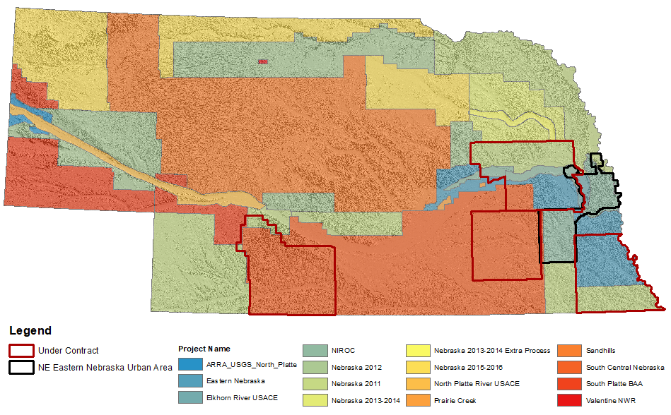
The state has complete LiDAR coverage and areas are being recollected to refresh the data and to make sure all the LiDAR data for the state is at a QL2 level. If there are partners who want to help with the cost for specific areas, please contact someone on the GIS council or the Nebraska State GIS Coordinator
Nebraska LIDAR Collection Status Application (Web App)
Standards and Guidelines
Elevation Acquisition using LiDAR Standards (NITC 3-203)
USGS LiDAR Specifications V1.2
Geospatial Metadata Standard (NITC 3-201)
Program Resources
- 2016 Elevation Plan and Partnerships (PDF)
- Elevation Business PlanElevation Business Plan (PDF)
- Elevation Working Group Charter MS Word DownloadElevation Working Group Charter (PDF)
- Business Plan Update Presentation PDFBusiness Plan Update Presentation (PDF)
- Program Goals and Objectives PDFProgram Goals and Objectives (PDF)
- Elevation Acquisition RFI (PDF)
- LiDAR Coverage Map Current Nebraska LiDAR Coverage Map (PDF)
- 3DEP Elevation Program USGS PDF3DEP Elevation Program USGS (PDF)